Culling MPAS Base Meshes to Land/River or Ocean/Sea Ice Regions
The e3sm/init component includes a workflow for culling MPAS base meshes to
produce meshes for specific regions, such as land/river or ocean/sea-ice
domains. This process uses remapped topography and mask information to remove
cells not belonging to the desired region, ensuring that the resulting meshes
are contiguous and scientifically meaningful for E3SM simulations.
Culling Workflow Overview
The culling workflow is composed of several modular steps, each responsible for a specific part of the process:
Mask Generation: The
polaris.tasks.e3sm.init.topo.cull.CullMaskStepcreates masks for land, ocean (with and without ice-shelf cavities), and Antarctic land ice. This step uses critical transects, flood-filling, and land-locked cell detection to ensure the masks are physically consistent and contiguous.Mesh Culling: The
polaris.tasks.e3sm.init.topo.cull.CullMeshStepuses the generated masks to cull the MPAS base mesh, producing separate meshes for land, ocean/sea-ice, and ocean without ice-shelf cavities. It also generates mapping files between the culled and base meshes, and graph files for the ocean meshes.Task Orchestration: The
polaris.tasks.e3sm.init.topo.cull.CullTopoTaskorchestrates these steps for each supported MPAS base mesh.
Step Dependencies
The typical dependency chain is:
RemapTopoStep(remaps topography to MPAS mesh, unsmoothed)CullMaskStep(creates masks for culling)CullMeshStep(culls the mesh to each region)
Configuration Options
The culling steps are configured through the [cull_mesh] section in the configuration file. Key options include:
cpus_per_taskandmin_cpus_per_task: Number of cores to use for culling.include_critical_transects: Whether to use critical land and ocean transects from geometric_features to enforce connectivity.sea_ice_latitude_threshold: Latitude above which transects are widened to prevent land-locked sea-ice cells.land_locked_cell_iterations: Number of passes to check for land-locked ocean cells.land_ice_max_latitude: Latitude, south of which critical land transects are considered to belong to land ice.land_ice_min_fraction: Minimum land-ice fraction for flood-filling the land-ice mask.
See cull.cfg for the full set of options.
The Antarctic land-ice ownership mask also includes southern cells that have already been removed from the open-ocean cull mask, so the cull workflow remains consistent with the remapped topography masks.
Workflow
Mask Generation: The
CullMaskStepcreates masks for ocean, ocean without cavities, land, and Antarctic land ice. It uses critical transects, flood-filling from seed points, and land-locked cell detection to ensure the masks are contiguous and scientifically meaningful.Mesh Culling: The
CullMeshStepuses the generated masks to cull the MPAS base mesh, producing separate meshes for land, ocean/sea-ice, and ocean without ice-shelf cavities. It also generates mapping files and graph files as needed.Output: The final culled meshes and masks are saved as NetCDF files for each region.
Supported Mesh Types
add_cull_topo_tasks registers tasks for all supported base meshes,
including both simple (quasi-uniform and icosahedral) base meshes and
named unified meshes (see Unified base-mesh tasks). The set
of mesh names is the union of get_base_mesh_step_names() and
UNIFIED_MESH_NAMES.
Example Usage
To get the shared cull steps for a specific mesh:
from polaris.tasks.e3sm.init.topo.cull import get_cull_topo_steps

steps, config = get_cull_topo_steps(
    mesh_name='u.oi30.lr10',
    include_viz=False,
)
To add the full culling workflow as a task for each supported mesh:
from polaris.tasks.e3sm.init.topo.cull import add_cull_topo_tasks

add_cull_topo_tasks(component)
Example: Culled Ocean Mesh
Below is an example of a 30-km ocean mesh from which land has been culled:
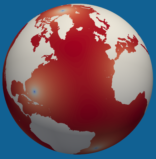
The culled mesh is contiguous and ocean flow has been ensured through the use of ocean critical transects (e.g. narrow straits) or blocked through the use of land critical transects (e.g. narrow peninsulas or isthmuses).
Customizing Mask Generation
Developers may wish to customize how masks are generated. To implement a custom
approach for generating masks, create a subclass of
polaris.tasks.e3sm.init.topo.cull.CullMaskStep and override methods
such as define_critical_land_transects, define_critical_ocean_transects,
refine_ocean_cull_mask, or refine_land_cull_mask. These methods receive the
geometric features, base mesh, topography, and current masks, and should return
updated masks as xarray.DataArray objects.
Example:
from polaris.tasks.e3sm.init.topo.cull import CullMaskStep

class MyCustomCullMaskStep(CullMaskStep):
    def refine_ocean_cull_mask(self, ds_base_mesh, ds_topo, cull_mask):
        # Custom logic for refining the ocean cull mask
        # e.g., add or remove cells based on scientific criteria
        return cull_mask
You can then use your custom step in place of the default CullMaskStep when
constructing your workflow.
Integration
To use your custom step, simply instantiate it in your workflow or override the step creation logic in your task or workflow setup.
For more details, refer to the docstrings and source code of
polaris.tasks.e3sm.init.topo.cull.CullMaskStep.